|
|
 |
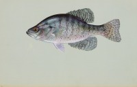
Calico Bass(White Crappie) Caught by Robert Taylor |
 |
Below are details for all the Calico Bass(White Crappie) caught by Robert Taylor. This view provides a great way to see where and how Robert Taylor caught Calico Bass(White Crappie).
Sort by: Max Fish Length | Max Fish Weight | Trip Name | # of Fish Caught
| From Trip: | Fishing Below The Lock And Dam |
| Trip Date: | 5/23/2008 |
| Hotspot Title: | Fishing below the lock and dam |
| # of Fish Caught: | 52 |
| Fish Length (Average): | 13 inches |
| Fish Length (Max): | 17 inches |
| Fish Weight (Average): | 1 lbs. 3 oz. |
| Fish Weight (Max): | 2 lbs. 12 oz. |
| Bait Type: | Minnow |
| Bait Details: | Used the drop shot method fishing the same red clay bank ledges in about 8' to 14' feet of water with live minnows. |
| Location Details: | The Demopolis lower pool area (lock and dam ) is a place where you can catch crappie in numbers from about the third week in Feb. to about the first week of June. Also we have a good run in the Fall. |
| Longitude/Latitude: | -87.88135528564449, 32.5198945062383 | |
| Map It: |  | |
| From Trip: | Good Crappie Fishing |
| Trip Date: | 4/28/2008 |
| Hotspot Title: | Good Crappie Fishing |
| # of Fish Caught: | 30 |
| Fish Length (Average): | 13 inches |
| Fish Length (Max): | 16.5 inches |
| Fish Weight (Average): | 1 lbs. 0 oz. |
| Fish Weight (Max): | 2 lbs. 10 oz. |
| Bait Type: | Minnow |
| Bait Details: | Using the drop shot method with live minnows. |
| Location Details: | Again I was fishing below the lock and dam fishing the red clay bank ledges from 8' to 14' depth. |
| Longitude/Latitude: | -87.8810119628906, 32.5204734871828 | |
| Map It: | | |
| From Trip: | Good Crappie Fishing |
| Trip Date: | 4/19/2008 - 4/20/2008 |
| Hotspot Title: | Good Crappie Fishiong |
| # of Fish Caught: | 120 |
| Fish Length (Average): | 12 inches |
| Fish Length (Max): | 16 inches |
| Fish Weight (Average): | 1 lbs. 0 oz. |
| Fish Weight (Max): | 2 lbs. 4 oz. |
| Bait Type: | Minnow |
| Bait Details: | Used the drop shot method with live crappie minnows. |
| Location Details: | Fished below the Demopolis lock and dam on the red clay bank ledges from 8' to 14' depth. |
| Longitude/Latitude: | -87.879638671875, 32.5198945062383 | |
| Map It: | | |
| From Trip: | Dr. Cagles Fishing Trip |
| Trip Date: | 5/24/2008 |
| Hotspot Title: | Dr. Cagles Fishing Trip |
| # of Fish Caught: | 60 |
| Fish Length (Average): | 12 inches |
| Fish Length (Max): | 16 inches |
| Fish Weight (Average): | 1 lbs. 0 oz. |
| Fish Weight (Max): | 2 lbs. 8 oz. |
| Bait Type: | Minnow |
| Bait Details: | WE used the drop shot method with live minnows fishing the red clay bank ledges in about 8' to 15' depth. |
| Location Details: | The lock and dam area of lake Demopolis is a combination of where both the Tombigbee and Warrior rivers meet as one river, starting about two miles above the lock in a North West direction. |
| Longitude/Latitude: | -87.88187026977542, 32.5209077204432 | |
| Map It: | | |
| From Trip: | Good Crappie Fishing |
| Trip Date: | 4/25/2008 |
| Hotspot Title: | Good Crappie Fishing |
| # of Fish Caught: | 90 |
| Fish Length (Average): | 12 inches |
| Fish Length (Max): | 15 inches |
| Fish Weight (Average): | 1 lbs. 0 oz. |
| Fish Weight (Max): | 2 lbs. 8 oz. |
| Bait Type: | Minnow |
| Bait Details: | Using the drop shot method with live minnows. |
| Location Details: | Again we fished the red clay bank ledges from 8' to 14' depth. |
| Longitude/Latitude: | -87.8803253173828, 32.5204734871828 | |
| Map It: | | |
| From Trip: | Night Fishing |
| Trip Date: | 6/6/2008 |
| Hotspot Title: | Night Fishing |
| # of Fish Caught: | 41 |
| Fish Length (Average): | 12 inches |
| Fish Length (Max): | 15 inches |
| Fish Weight (Average): | 1 lbs. 0 oz. |
| Fish Weight (Max): | 2 lbs. 8 oz. |
| Bait Type: | Minnow |
| Bait Details: | I used up the 1/8 lb of crappie minnows that I started with and caught shad and river minnows with a bait dip net around the evening fishing secret for the remainder of the trip. |
| Location Details: | |
| Longitude/Latitude: | -87.8353500366211, 32.5439190802748 | |
| Map It: | | |
| From Trip: | Crappie Fishing |
| Trip Date: | 5/2/2008 |
| Hotspot Title: | Crappie Fishing |
| # of Fish Caught: | 30 |
| Fish Length (Average): | 11 inches |
| Fish Length (Max): | 14 inches |
| Fish Weight (Average): | 1 lbs. 8 oz. |
| Fish Weight (Max): | 2 lbs. 0 oz. |
| Bait Type: | Minnow |
| Bait Details: | Using a B & M 16' crappie fiberglass pole with a float, 3/8 oz. weight and a 3/0 gold aberdeen Eagle Claw hook. Fished around sunken tree tops in about 12 feet of water, fishing about 5' deep. |
| Location Details: | This slough off of the Black Warrior river is called the power line slough. It has a lot of dead standing timber, stumps, logs and tree tops. |
| Longitude/Latitude: | -87.79586791992189, 32.5543373793085 | |
| Map It: | | |
| From Trip: | Crappie Fishing |
| Trip Date: | 5/10/2008 |
| Hotspot Title: | Crappie Fishing |
| # of Fish Caught: | 30 |
| Fish Length (Average): | 12 inches |
| Fish Length (Max): | 14 inches |
| Fish Weight (Average): | 1 lbs. 2 oz. |
| Fish Weight (Max): | 2 lbs. 3 oz. |
| Bait Type: | Minnow |
| Bait Details: | Again I used my fiberglass 16' B&M crappie pole, live minnows, float, 3/8 oz. weight and 3/0 Eagle Claw gold hook. I fished around dead standing timber in about 11' of water about5' deep. Also used an ultra light rod with Mr. Twister spinner with a smoke colored sassy shad in the 1/4 oz. version. |
| Location Details: | French Creek is a very large slough, by my standards, that has plenty of dead under water stumps, dead standing timber, submerged logs and tree tops to fish around. |
| Longitude/Latitude: | -87.7993011474609, 32.5230788552712 | |
| Map It: | | |
| From Trip: | Fishing the Tombigbee River |
| Trip Date: | 5/16/2008 |
| Hotspot Title: | Fishing the Tombigbee River |
| # of Fish Caught: | 26 |
| Fish Length (Average): | 12 inches |
| Fish Length (Max): | 13.5 inches |
| Fish Weight (Average): | 1 lbs. 0 oz. |
| Fish Weight (Max): | 1 lbs. 12 oz. |
| Bait Type: | |
| Bait Details: | Used live minnows with the pushing method, weight on the bottom and two hooks above and pushed around the dead stumps and live cypress trees. |
| Location Details: | Taylor's slough is about 9 miles from the Demopolis city landing up the Tombigbee River. The water depth ranges from about 3' deep to 14' deep |
| Longitude/Latitude: | -87.9077911376953, 32.589345576065604 | |
| Map It: | | |
|
|
|
Sponsored Links |
|
|
|
|